Polaris--the Polar Star--our North Star--was the guiding light of the Pilgrim world. It did not rotate with the other stars but held steady at the core of their universe while the others circled it. Centering on this star in the northern sky opened a sweeping perspective of the heavens.There's no question that astronomy was a fundamental source of knowledge that bolstered their religious beliefs. http://vimeo.com/4330429. The Pilgrims were men of the New Testament taking their script from the Old. They held monotheism as sacred-- the belief in one God reigning supreme. Polaris fit the part perfectly. Adventurers of the enlightenment had their "lonestar."
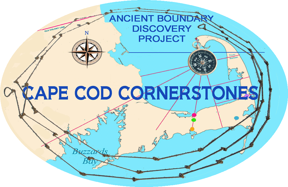
The Pilgrims knew when they observed a magnetic compass that the needle pointed to a place in the sky slightly west of their alignment with the North Star. Astronomical measurements calculated this "degree of variation" at 13º west longitude in the 1630's. This variation then floated down from 13º west to 6º west by the 1800's but slowly rose again to 17º by the 1970's. The degree of variation on Cape Cod has now crested and is on its way down now ranging near 15º.
Geologists think that the change in variation is related to the shifting in the molten core in the earth. The theory is that a mass of iron near the North Pole is rotating and causing this shift in variation in a cycle of about 400 years. The Pilgrims would have relied on 13º west longitude for their compass readings as evidence by the first land survey of Cape Cod undertaken in the mid-1630's.
Sunday, December 4, 2011
Sunday, July 10, 2011
Former W.Va. lawyer works to preserve Pilgrim history
July 10--CHARLESTON, W.Va. -- A lawyer who once practiced in West Virginia is now working to preserve the early history of the Pilgrims and Cape Cod in Massachusetts.
Michael Farber works with people who recently built an exact replica of the Elizabeth Tilley, a shallop used by Pilgrims after they landed on Cape Cod back in 1620. Read more
Michael Farber works with people who recently built an exact replica of the Elizabeth Tilley, a shallop used by Pilgrims after they landed on Cape Cod back in 1620. Read more
Sunday, June 19, 2011
History buffs recreate slice of Pilgrims' progress

ORLEANS — Of all the beautiful boats lining Rock Harbor on Saturday, none looked better than the richly oiled, wooden Elizabeth Tilley, which arrived under tow from Plymouth to commemorate a voyage made by the Pilgrims 385 years ago. Read more
Wednesday, June 15, 2011
Pilgrims Land in Orleans

Many find it easier to base the spirit of America on the stalwart souls who made the trip in 1620, rather than the “bunch of drunken entrepreneurs” who came across later, said Mark Wilkins, executive director of the Chatham Historical Society, but the 45-foot Sparrow-Hawk has an intriguing place in the history books, co-starring Mayflower passengers, which will be brought to life this month.
Read more: Pilgrims to land in Orleans - - Wicked Local - Cape Cod http://www.wickedlocal.com/capecod/archive/x1534029089/Pilgrims-to-land-in-Orleans#ixzz1U5YKPEwd
Saturday, March 5, 2011
The Eastham Transcription Project is now up and running
Michael Farber wants Eastham folks to be aware that the Cornerstone Project last fall launched an initiative to transcribe the ancient town records from 1659 to 1710.
Read more: Cornerstone project - - Wicked Local Eastham http://www.wickedlocal.com/eastham/archive/x2022449451/Cornerstone-project#ixzz1U5XrUFs5
Read more: Cornerstone project - - Wicked Local Eastham http://www.wickedlocal.com/eastham/archive/x2022449451/Cornerstone-project#ixzz1U5XrUFs5
Wednesday, December 8, 2010
Exciting Re-Discovery of Cape Town Boundaries

Friday, November 19, 2010
Group will retrace Pilgrim William Bradford's steps

Read more: Group will retrace Pilgrim William Bradford's steps - - Wicked Local - Cape Cod http://www.wickedlocal.com/capecod/archive/x291607657/Group-will-retrace-Pilgrim-William-Bradfords-steps#ixzz1U5amvKds
Thursday, February 11, 2010
Exploring ancient mysteries: HCT program focuses on historical cornerstones Read more: Exploring ancient mysteries: HCT program focuses on historical cornerstones

Read more: Exploring ancient mysteries: HCT program focuses on historical cornerstones - - Wicked Local - Cape Cod http://www.wickedlocal.com/capecod/archive/x228083066/Exploring-ancient-mysteries-HCT-program-focuses-on-historical-cornerstones#ixzz1U5c07l2z
Friday, December 4, 2009
Morse Payne Cornerstone Project
Thursday, June 18, 2009
History uncovered at Orleans windmill site
By Susan Milton
smilton@capecodonline.com
ORLEANS - The Jonathan Young Windmill looks at home on Town Cove in Orleans, but the historic landmark has moved around since its construction in the early 1700s.
Yesterday about 15 people walked through the woods to see the windmill's likely first home on a hill in South Orleans. Marking the spot is a circle of large foundation stones rediscovered recently by amateur historian Michael Farber of Chatham.
"Everything fits," said miller and historian James Owens of Eastham, among those who came to see Farber's rare discovery in the town's watershed off Route 28.
Even the stones in the middle of the circle were historically correct, Owens said, describing how four to five-ton millstones "floated" in a support on a central foundation to keep weight off the walls of the mill. Read more ...
Subscribe to:
Comments (Atom)